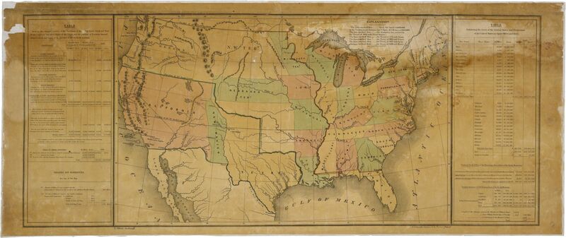
Map of the United States Including Western Territories
Item
-
Title
-
Map of the United States Including Western Territories
-
Type
-
Image
-
Description
-
"This map was ordered by President James K. Polk to accompany his annual message to Congress in December 1848. Principal draftsman Ephraim Gilman, of the U.S. General Land Office, created the map to show all of the existing states, territories, proposed territories, and the area of the Mexican Cession in the southwest acquired by the terms of the Treaty of Guadalupe Hidalgo, which ended the war with Mexico.
It represents Polk's conception, as a Southern Democrat, of how to divide up the new territory acquired through the Treaty. It became the starting point of debates in Congress over slavery and westward expansion." [Description from the National Archive]
-
Date
-
Diciembre 1848 // December 1848
-
Rights
-
Public Domain, Free of Known Copyright Restrictions
-
Creator
-
National Archive
-
Format
-
597KB JPEG
-
Publisher
-
Records of the U.S. House of Representatives
-
Alternative Title
-
Mapa de los Estados Unidos Después de la Firma del Tratado de Guadalupe Hidalgo // Map of the United States After the Signing of the Treaty of Guadalupe Hidalgo
-
Identifier
-
National Archives Identifier: 2127339
-
Bibliographic Citation
-
Full Citation: Map of the United States Including Western Territories; 12/1848; (HR29A-B1); General Records, 1791 - 2010; Records of the U.S. House of Representatives, Record Group 233; National Archives Building, Washington, DC. [Online Version, https://www.docsteach.org/documents/document/western-territories-map, April 7, 2023]


